Abstract
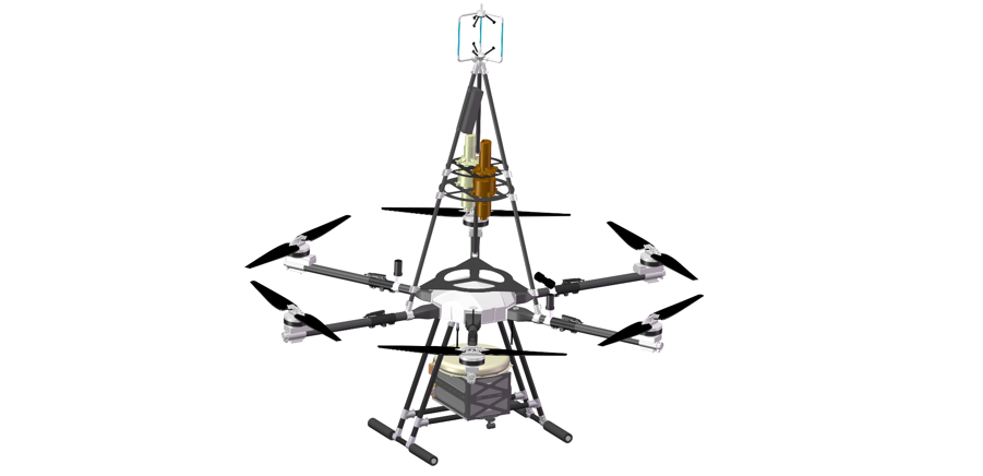
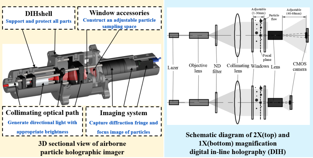
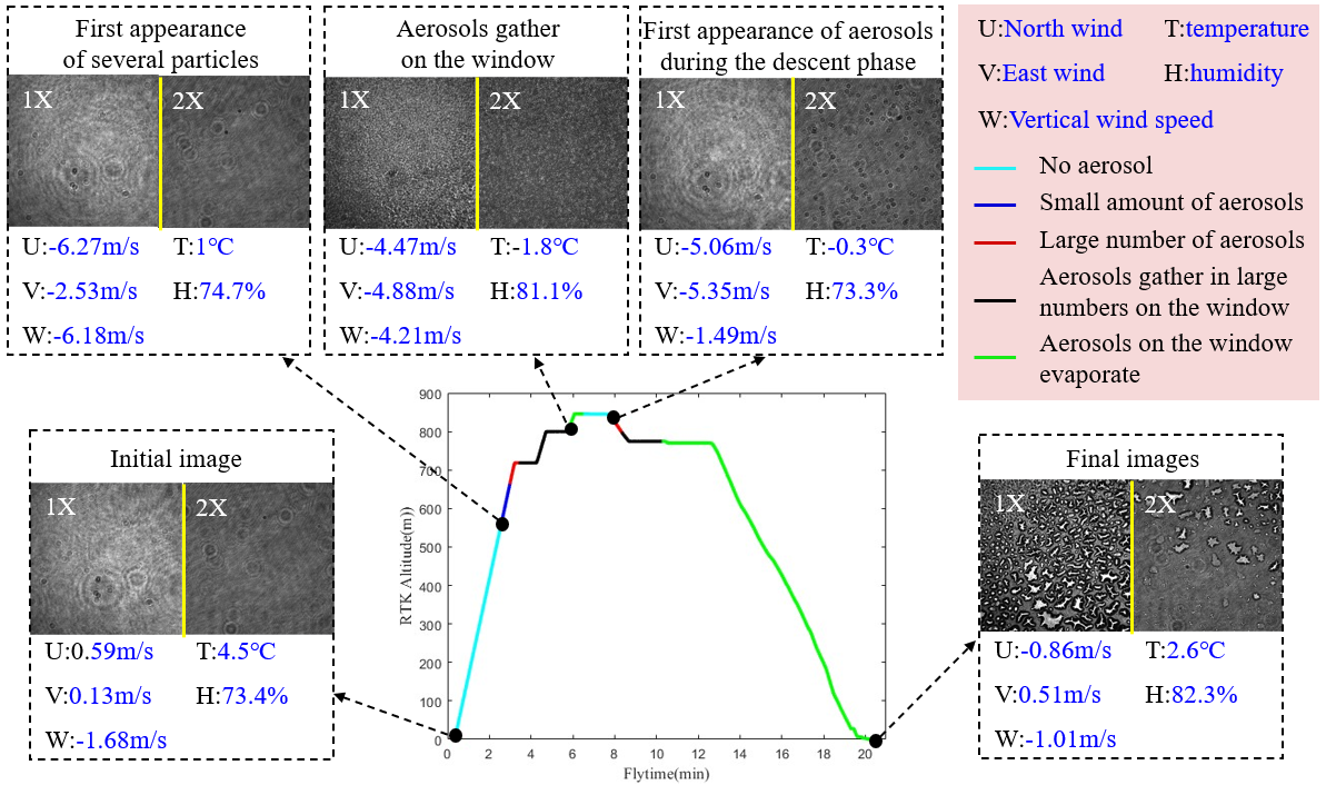
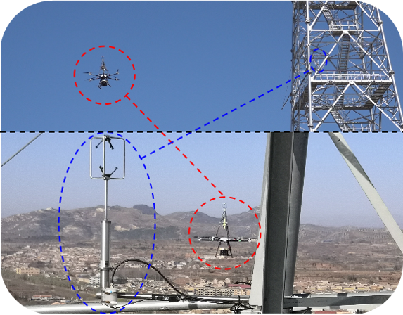
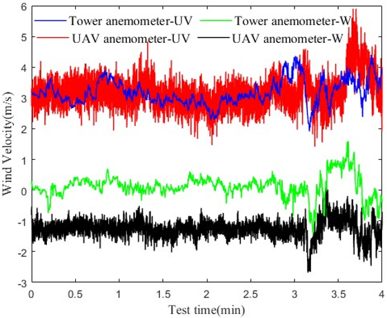
Atmospheric aerosol is of critical relevance in environment, meteorology and atmospheric fluid dynamics research. Its particle size, morphology, concentration and spatial distribution change greatly, which makes it challenging to quantify. A multi-resolution holographic particle imaging and atmospheric turbulence measurement UAV developed in this paper can realize the high-altitude in-situ characterization of atmospheric particles with a particle size of O(10 0-10 3)µm. The platform integrates UAV technology, multi-resolution digital in-line holographic imaging (optical magnification of 1X and 2X), multi-sensor such as three-dimensional ultrasonic anemometer (sampling frequency 20 Hz). In order to reduce the influence of the UAV rotor wake on the test range, the vertical distance between the UAV wind speed measurement position and the rotor is around 1 m. The UAV platform was first tested systematically on the ground using the UAV wind wall (with a dimension of 3 x 2 m, WindShaper, Switzerland). In the experiment, the influence of rotor suction on three-dimensional anemometer measurement is quantified; The cloud simulated by the atomizer is imaged by digital in-line holography. The results show that the UAV platform is capable of resolving microscopic particles under varying working conditions. The data can be used to obtain the particle size, shape, concentration and spatial distribution through three-dimensional reconstruction. The influence of the rotor on the mean flow measurement is less than 5%. The UAV flight platform will provide technical support for in-situ characterization of particles and flows within atmospheric boundary layer.