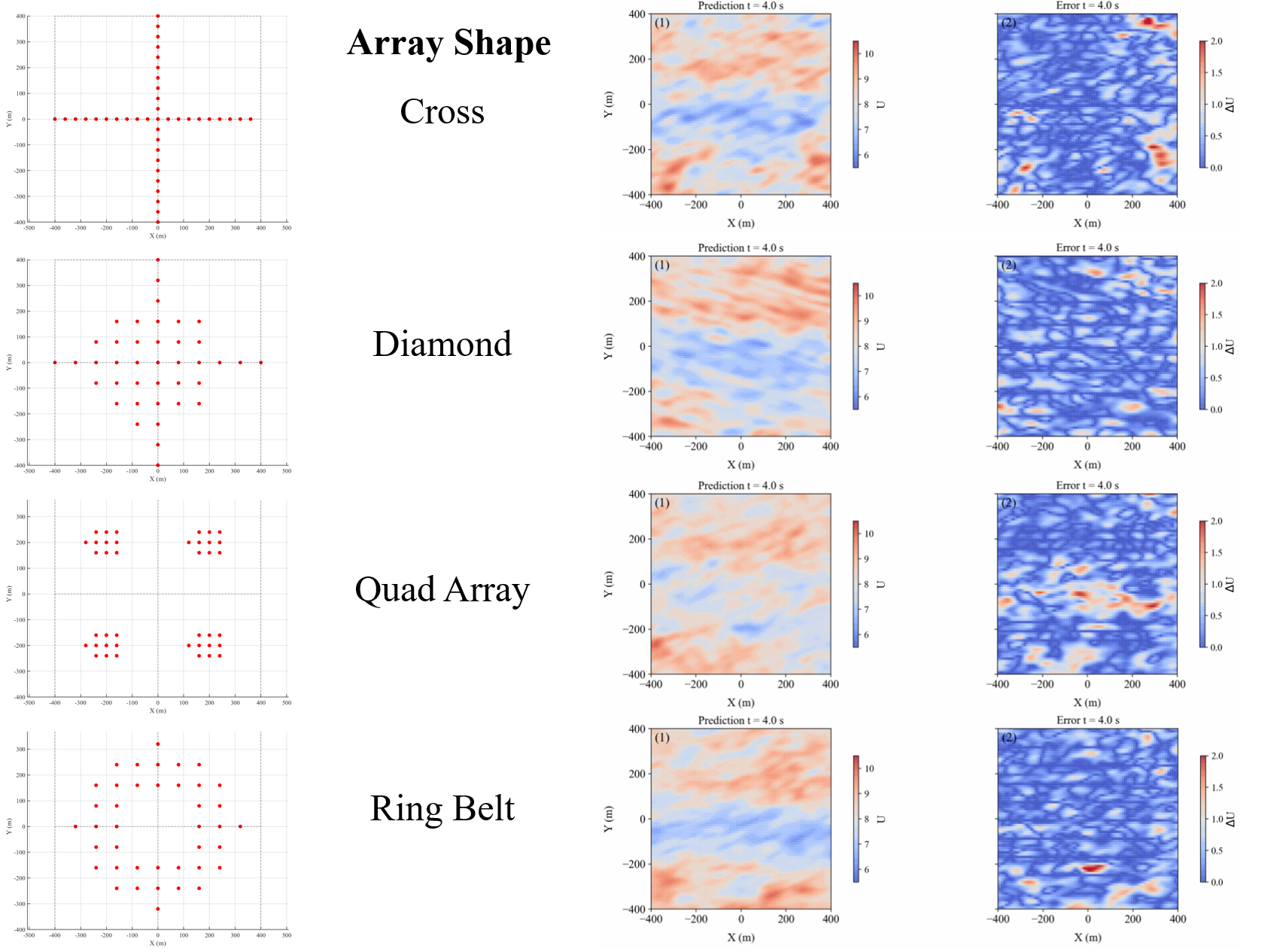
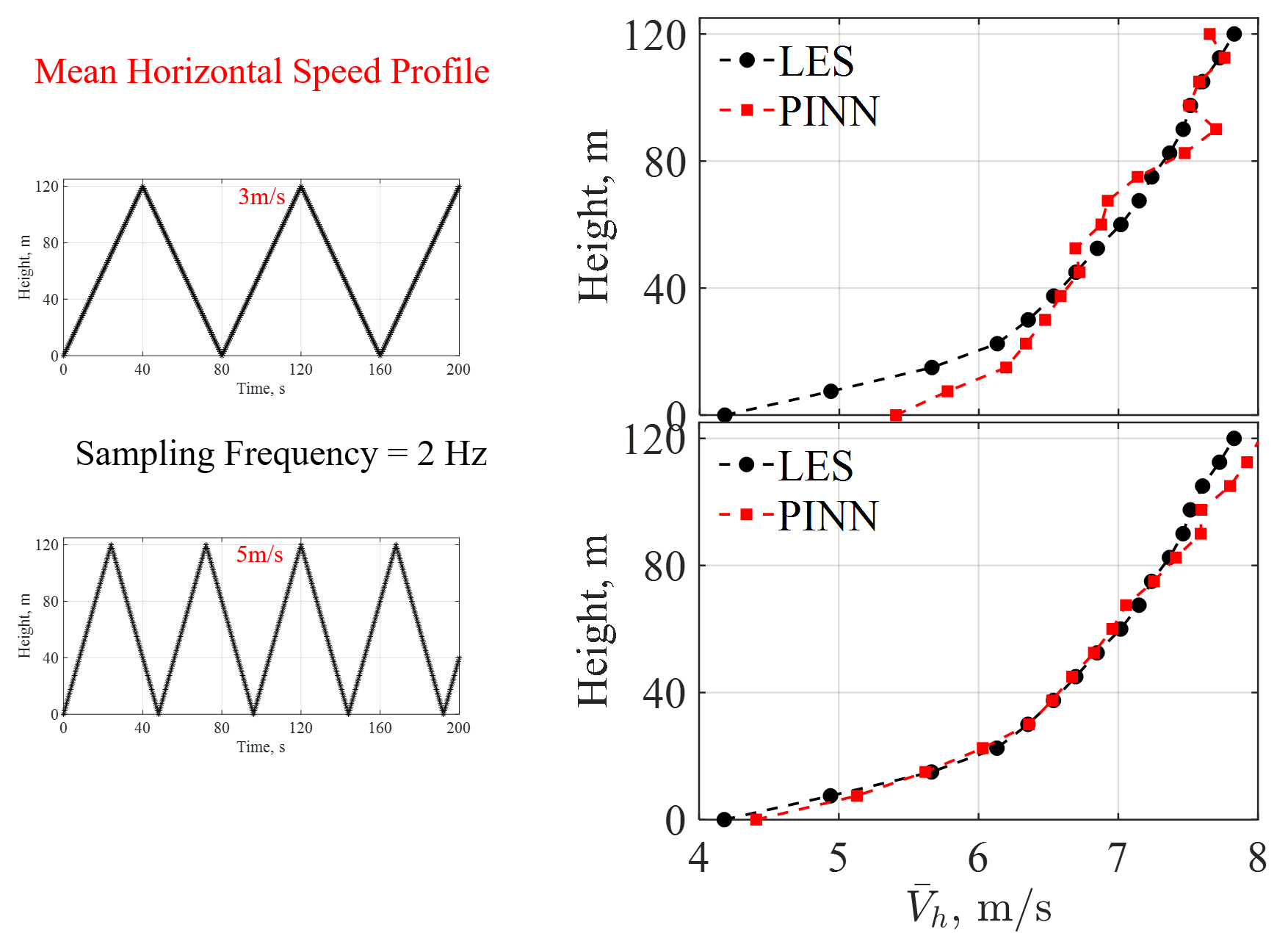
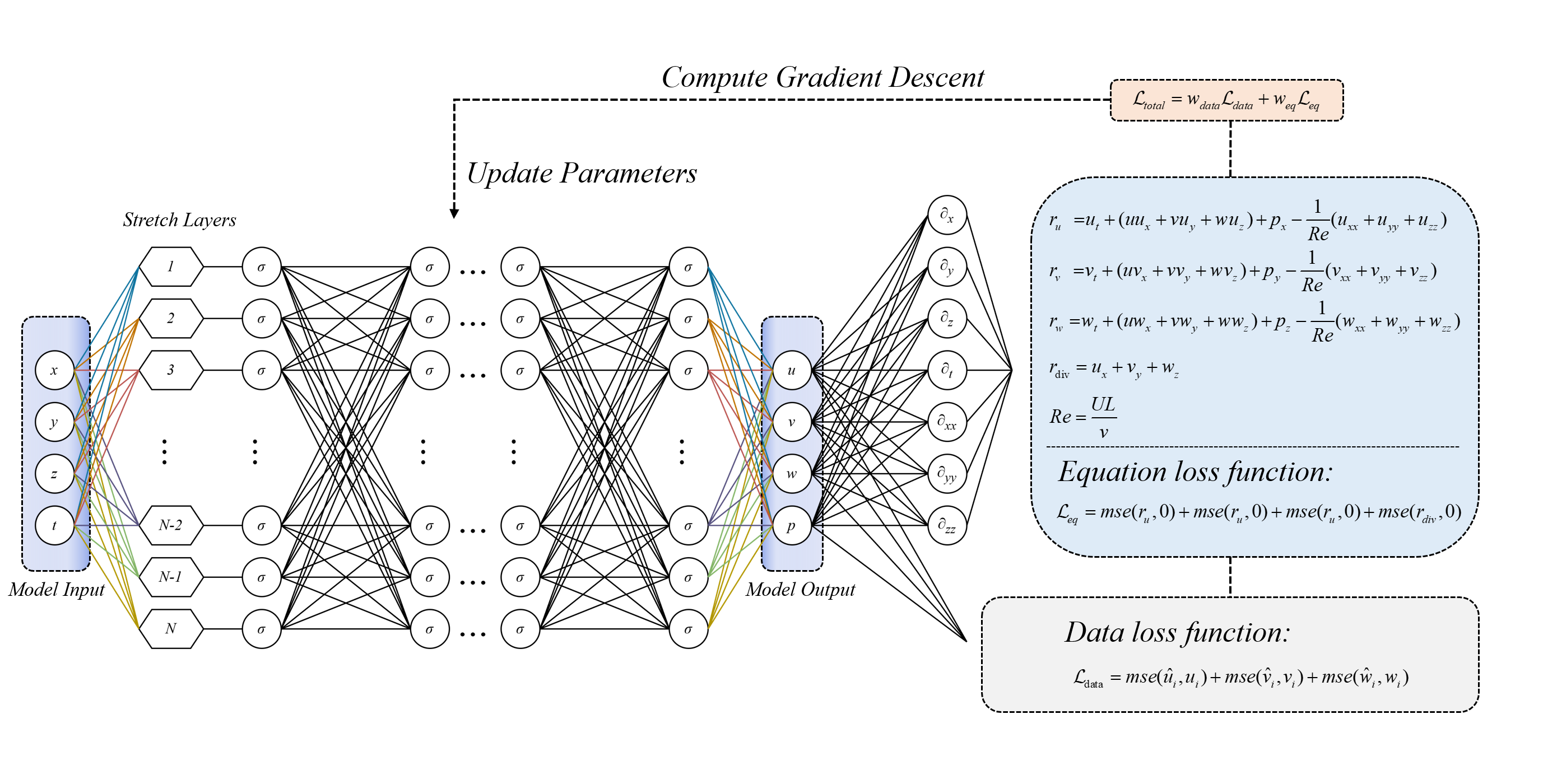
Characterizing turbine-scale atmospheric boundary layer (ABL) flows is a critical part of the wind power industry. Current flow characterization methods around wind turbines have clear drawbacks, and that is why we need a more flexible, economical, and deployable platform for wind field characterization. To achieve this goal, we utilize Unmanned Aerial Vehicle (UAV) platforms as a new solution platform. Through the Physics Informed Neural Network (PINN), we can reconstruct wind fields using a small amount of collected data. PINN tightly couples data and physics by embedding the governing Navier–Stokes equation and continuity residuals into the learning objective via automatic differentiation, allowing the network to infer unmeasured states and unknown parameters while enforcing equation consistency even where data are sparse. Here, we apply a method validation using synthetic UAV measurements drawn from Large-Eddy Simulation (LES) datasets. By providing mobile, in-situ sampling that captures 3D wind structure and assimilating it within a physics-informed model, this UAV-enabled framework aims to deliver accurate, uncertainty-aware 4D reconstructions that directly support turbine-level decision-making for higher efficiency and safer operations.


To emulate UAV sampling, three measurement strategies are considered, including phase-resolved scanning, hovering measurements, and vertical scanning for boundary-layer profile reconstruction. Figure 3 is our first UAV sampling strategy: phase-resolved scanning. We conducted a preliminary analysis of the impact of UAV number on horizontal-plane reconstruction. As the single-flight scanning area decreases, the reconstruction error also decreases. In Figure 4, we show the reconstruction result for a vertical plane with a single-flight scanning area of up to 24,000 m². The reconstruction quality is also satisfactory, capturing the main flow structures.


This is our second UAV sampling strategy: hover measurements. All cases share the same single-flight scanning area of 16,000 m², but the UAV array shape differs. As shown in the reconstruction results, all four shapes can basically reconstruct the flow structure of the plane, although the quad-array shape performs slightly worse.

Finally, this is our third UAV sampling strategy: vertical scanning for boundary-layer profile reconstruction. Here, we compare the reconstruction results obtained at UAV flight speeds of 3 m/s and 5 m/s. As shown in the mean horizontal wind-speed profile, the reconstruction accuracy improves as the flight speed increases.

Address: 241 Daxue Road, Jinping District, Shantou, Guangdong Province, China
©Guangdong Technion-Israel Institute of Technology 2018
粤ICP备17036470号,版权所有©广东以色列理工学院