Abstract
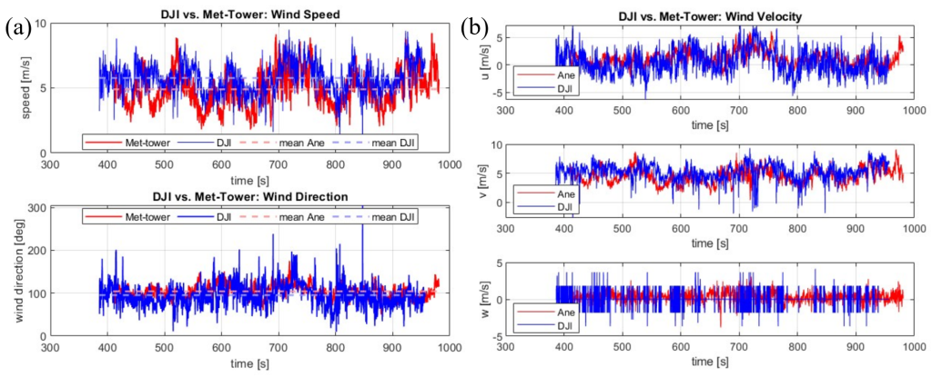
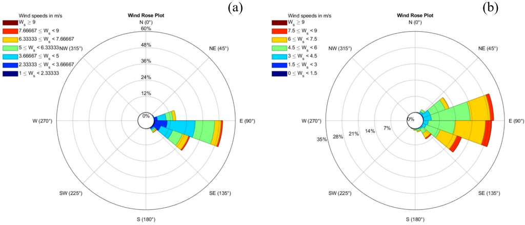
This study presents a comprehensive investigation of wind field estimation using quadrotor UAV tilt angle dynamics, combining indoor calibration experiments with outdoor validation against meteorological tower measurements. A data-driven model is developed relating wind speed U to the quadrotor’s tilt angle λ and wind direction angle γ through the equation U^2=k(γ )∗tan(λ), where the coefficient k(γ) is empirically determined as a cubic polynomial function via controlled indoor experiments. The DJI Mavic3 Pro quadrotor serves as the experimental platform, with its attitude data validated against high-frequency (100 Hz) vision measurements showing strong correlation. Outdoor field tests demonstrate the model’s capability in estimating wind speed (mean 5.76 m/s vs reference 4.89 m/s) and direction (95.4◦vs reference 104.9◦), though wind rose analyses reveal directional discrepancies under turbulent conditions. Key challenges identified include high-wind vibrations and broader directional distributions, with proposed improvements focusing on adaptive parameter tuning and sensor fusion. The results establish that tilt-angle based wind estimation offers a portable alternative to traditional anemometry, particularly for low-altitude atmospheric studies, while highlighting the need for dynamic model refinement in high-wind scenarios. These findings provide a foundation for future work in real-time adaptive control and multi-sensor integration for improved UAV-based wind field characterization.